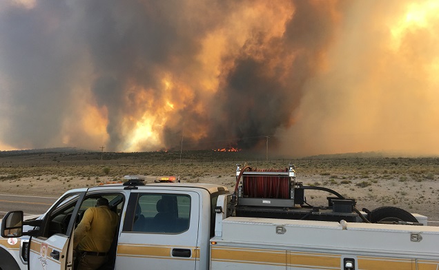
As of Sunday, 7/08/18, the Hogan Fire is now 10,955 acres and is 25 percent contained. Continue operations with direct support of crews, aircraft, and engines. Utilize engines in the more accessible country outside the WSA, and utilize hand crews supported by aircraft in the WSA. Secure and hold existing line. Rehab will begin in the east side of the fire in the WSA.(40.737 latitude, -114.596 longitude)
Projected Incident Activity: Fire is projected to increase by 50 acres by the end of the day. Fire will continue to move west burning along the east facing slope of the Pequop Mountains and in the flats along the base of the mountain. Division Brav conducted a burnout operation and tied in the southern portion of the fire and are monitoring for spots. Gusty and erratic winds that are predicted over the fire
area today could cause fire growth in multiple directions. (Acreage increase is due to more accurate mapping).
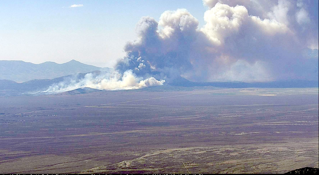
A new fire in Clover Valley closed U.S. Highway 93 south of Wells late Thursday afternoon (7/05/18) and sent up a massive cloud of smoke that was visible from Spring Creek and Lamoille.

The Echo Fire was reported around 10:15 the morning of July 5, 25 miles south of Wells. By 10:15 p.m. it had burned an estimated 10,000 acres.

As per Monday 7/09/18, the Echo Fire is now 41 percent contained and remains at 6,438 acres with a decrease in fire behavior. The fire is now exhibiting minimal behavior with smoldering and creeping. More than 300 personnel remain on the fire composed of federal, state, county, local and private.(40.696 latitude, -115.076 longitude)
The highway was closed last July 5th, in both directions to State Route 229 until shortly after midnight.
Eighteen engines were on the scene west of Snow Water Lake, along with three heavy air tankers and four single-engine air tankers.
The fire exhibited “growth all afternoon and into the evening. A consist southern wind pushed the fire,” officials reported. It was zero percent contained.
The cause of the fire is under investigation.
Another fire near Currie was started by lightning on Wednesday. The Boone Springs Fire was originally reported at 20 acres but by 11 p.m. Wednesday, July 4th. It was estimated at 1,200 acres.
As per Monday 7/09/18, the Boone Springs Fire is now 90 percent contained and 3,073 acres. Firefighters are continuing to monitor fire line and mop up.
Also, a small band of thunderstorms skirted the southeastern corner of Elko County on Wednesday (July 4th), while the remainder of the region remained clear and dry.


